Showing posts with label Roman Britain. Show all posts

Friday, 17 April 2015

Where was the northernmost point in the Roman empire?

If you take yourself along the B6318 west of Newcastle, as you crest a hill and pass by a small copse a few miles past Chollerford, you’ll take a kink in the road without really noticing it.

There’s no signpost, but this unassuming spot has a claim to be the northernmost point in an empire that stretched from here to the Sarahan Desert.

Limestone Corner is at the site of Milecastle 30

It’s not the furthest north the Romans ever got, admittedly. They once had military outposts as far as the Firth of Forth, and their armies ranged right up into the Highlands. The historian Tacitus even claimed (somewhat dubiously) that his father-in-law, the general Agricola, ‘discovered and subdued’ the Orkneys in AD 98.

But Hadrian’s Wall gets bonus points for being a permanent frontier, and this spot, known as ‘Limestone Corner’, is definitely the northernmost point on the Wall.


No trace of the Wall survives here. It was unhappily demolished in the eighteenth century, its smashed and pounded stones used as the foundation of a military road connecting Newcastle and Carlisle, the present B6318. (Antiquaries of the time were horrified, denouncing the military engineers as ‘Goths’ and ‘Vandals’ for committing so gross an act of desecration.)

But never mind, since the spot has become famous not for the Wall, but for the defensive ditch that once ran in front of it. The ditch survives pretty well, and is unusual for being choked with massive boulders.

Usually, Roman legionaries were ruthlessly thorough in their engineering projects. They cut roads straight as arrows through the most hostile landscapes, threw up forts in sometimes ridiculous places.

View of Housesteads Crags - the legionaries were surely chuffed that no ditch was needed here...
Heading east to Limestone Corner, with the ditch visible in the middle of the photo

With the same bloody-mindedness they dug a ditch in front of the Wall, shovelling deep into clay, peat, and rock. But when they came to Limestone Corner the legionaries hit a snag in the form of a massive outcrop of stone that little short of dynamite was going to shift.

Realising that dynamite wouldn’t be invented for another 1750 years, they gritted their teeth and went ahead anyway.

God alone knows how much sweat and cursing ensued. If you squint, you can actually still detect a blue tint in the air hovering over the ditch. To be fair, they ended up with a ditch of sorts, just not quite as polished as their usual work. Crags jut out from either side, and the base of the ditch is strewn with boulders leading up to one particular monster that squats smugly right where nature put it.


Looking down at the top, you can still see the holes cut by legionaries in their vain attempts to demolish it. It isn’t hard to imagine a small crowd of Roman soldiers gathered round it, some muttering obscenities as they chisel away, some scratching their heads, others offering unwelcome advice as men tend to do in such situations, until the leader of the detail says: ‘Fuck it, it’s lunchtime.’ At which point they down tools, and then decide it isn’t worth the hassle to come back.


The empire had finally found its limit. It could chisel away all it wanted, but the north was never going to crack.

All photographs © John Henry Clay

Saturday, 11 January 2014

A Kentish jaunt

It’s odd that you can live for three decades in a country the size of England and still never have visited whole corners of it. 

Kent is one of those corners for me. Last week I ventured down to the mysterious lands beyond the M25 with my brother, a fellow Roman nut.

Cantia incognita

A typical Kentish scene
Growing up in Worcestershire, we heard all manner of tales about the Kentish folk. People spoke of them as Pliny and Martianus Capella had once spoken of the Blemmyes of Nubia: ‘They have no heads,’ they said, ‘and their eyes and mouths are on their chests.’ Some claimed that no such place as ‘Kent’ even existed, or if it did, it was probably in France.

So it was with great excitement and trepidation that we hurled ourselves over the Dartford Crossing, half-expecting to fall off the edge of the world.

As it turned out, Kent is lovely, even in the gloomy greyness of January. We only had one full day to explore, and had a few places we definitely wanted to see. For the most part these weren’t the usual tourist sites, which was useful, since a lot of those places are closed on winter weekdays.

Landing site

First stop was the beach between Walmer and Deal, the (probable) landing site of Caesar in his two expeditions to Britain. Nowadays this is a heavily stepped shingle beach that feels very exposed to both seaward and landward weather, hardly ideal for a massed landing of the two legions that Caesar brought over from Gaul in 55 BC.

When Caesar returned in 54 BC, he brought five legions; the later Claudian conquest involved about 40,000 troops, including both legionaries and auxiliaries.

Compare this with the size of the Norman invasion army in 1066, which probably numbered fewer than 10,000 men - the size of Caesar's initial 'scouting' force. Yet with this tiny army, Duke William was essentially able to conquer England after a single pitched battle. This highlights one of the most striking things about early medieval warfare, i.e. how small-scale everything got after the collapse of the empire.

Anyway, back to the Romans. The landing site was probably different in Caesar’s time, though, as this part of the Kentish coast has shifted and changed a lot over the centuries. The beach may have been sand instead of shingle, and sheltered somewhat by sand bars off the coast. In any case, Caesar chose the same site for his full-scale invasion the following year.


There's a modest monument to Caesar close to the beach, an unassuming flat sculpture with his head in profile. As you can see from the picture above, it could do with a bit of a scrub.

Hillforts

It was during his second invasion that Caesar ventured properly inland, fighting a skirmish next to a river usually identified as the Great Stour outside Canterbury, and capturing a hillfort that is commonly thought to be Bigbury. It’s the strongest contender, at any rate.

View from the Stour - the slight rise on the left skyline is the optimistically named 'Bigbury' hillfort

There isn’t much of archaeological interest to see at Bigbury now. The summit is occupied by leafy lanes and idyllic houses and gardens, and few of the surviving ramparts are accessible, though some were excavated in the 1970s. It was useful to visit the site, though, just to get some idea of its size and setting. As hillforts go it’s not an especially formidable one, which is why Caesar apparently captured it so easily (having 20,000 legionaries probably also helped).

The south gate at Oldbury - from this imposing entrance, the path runs up a narrow channel with ramparts on either side

Much more impressive was Oldbury in west Kent, just off the M26. This much larger hillfort dates from around the same time and may also have been captured by Caesar’s troops. Nowadays the entire hill is laced with tracks and bridlepaths snaking through dense woodland, so it’s hard to get a sense of the overall scale from the ground – that is, until you find yourself confronted by the surviving ramparts, which are still intimidating after two thousand years. When first constructed, even grizzled Roman legionaries must have found them a fearsome prospect.

Museum

A slave about to strangle her mistress...?
Canterbury Roman Museum was also a highlight, with its fine reconstruction scenes and selection of genuinely interesting artefacts. I've added a selection of photos from the museum below.

My own favourite items were the most mundane: a messy chi-rho scratched on the bottom of a dish, and an iron hinge-pivot that was found in situ during an excavation of one of the Canterbury city gates.

(I didn't know I could get so excited about a hinge-pivot, but being trained as an archaeologist does weird things to you.)

There’s clearly much more Roman stuff to see in Kent. Two sites I really want to visit, both sadly closed this time, are Richborough Roman Fort and Lullingstone Roman Villa – they’ll be top of my list on the next trip. If you have any other recommendations, leave a comment below!

The early Christian chi-rho symbol inscribed on bottom of dish

The wonderful hinge-pivot

If you squint, you might be able to make out the tiny chi-rho inscribed in the bowl of the lower spoon

Roman mouse

A late Roman soldier
Roman Canterbury at its height in the second century

Anglo-Saxon Canterbury, c. 700 - note the remains of the theatre, and the new cathedral complex in the distance

Friday, 3 January 2014

Hardknott Pass - a Roman vanity fort?

Taking a shiny, brand-new rented car up the steepest road in England seemed like a good idea.

At least, until I started to do it. That was when I saw that the 1:3 gradient wasn’t the issue. The steepness is fine. The issue is everything else: the coiling switchbacks; the one-car width of the road; the naked verges that mean there is nothing between you and the rocky valley floor 500 feet below; and, worst of all, everyone else who is trying to come down the same narrow road at the same time as you, and is equally reluctant to have their car turn into a tumbling metal coffin – a fate narrowly missed by an American tourist on neighbouring Wrynose Pass a few months back.

To drive over Hardknott Pass, you need two things: a head for heights, and good clutch control. A sturdy handbrake also helps.

It doesn’t hurt to pray in advance for dry weather, either. If you do, I’d recommend making a sacrifice to Mars, because the main reason to put yourself through the trial of Hardknott Pass is to visit the Roman fort situated near its summit.

View from the fort, looking east to Hardknott Pass half a mile away

At the roof of Roman Britain

This fort, Mediobogdum, is easily one of the most impressively situated Roman forts in Britain. Actually, probably not many forts in the entire empire could compete with its dramatic setting. The peaks of the Lake District rise like thunder on every side, an ominous backdrop of scree and broken shoulders of volcanic rock. The monotony of grey stone and russet-brown grass is broken only by the shining patches of snow that hide in mountainside clefts and hollows until the end of spring.

Remains of the bath house (left) and the south corner of the fort (right)

If a Roman defined civilisation in terms of urban life and cultivation, then this landscape was as barbaric as it came. Rocky it may be, but every other step lands you in a bog, especially after the winter when the ground is saturated with meltwater. There is hardly a level patch of ground to build a single house, never mind an entire fort. Clearly, nothing much is going to grow up in this miserable soil, with the cold wind whipping over the pass.

But when did the Romans ever give up so easily? Despite its remoteness, despite the challenges, with typical bloody-mindedness they built a fort up here in the AD 120s. This was around the same time as the construction of Hadrian’s Wall, so there was a serious amount of engineering ‘can-do’ in the air. They built a road, drained the boggy ground, hauled rocks from the peaks, and threw up a fort that looked as tough as the mountains around it.

Outside the fort they even levelled an area larger than a football pitch by cutting into the side of the mountain – though quite why they did this is a mystery. It is generally interpreted as a parade ground, which makes me wonder if Mediobogdum was a specialised training fort, a place to drill recruits and toughen them up before sending them to guard the rugged northern frontiers of Britain.

The 'parade ground' above the fort

Abandoned

Even so, the fort was only occupied for a short period, probably no more than a generation. Then it was abandoned. This says a lot about the remoteness of the setting, guarding a mountain pass that could not have seen a great deal of traffic at the best of times. Impressive, sure, but not a practical use of military resources.

I’m guilty of a sleight of hand in The Lion and the Lamb, where I have the fort being reoccupied in the fourth century. This probably never happened. True, some fourth-century coins have been found at Mediobogdum, which makes me feel a bit better, but they might just as well be evidence of passing traders making use of the abandoned ruins.

Yet all you have to do is visit this place, a monument to Roman determination at the roof of Britain, look up at the looming mountains and down into the deep haven of Eskdale to the west, feel the sharp air gusting in from the coast, and imagine how it would have been for the soldiers trapped in this fort through the bitter grip of winter – and then you can forgive a little dramatic licence.

Eskdale, with the Irish Sea just about visible on the horizon

Tuesday, 31 December 2013

Great Witcombe - a hidden gem of Roman Britain

If you’re unfortunate enough to be stuck in a car with me while driving up the M5 past Gloucester, you might end up getting dragged to one of Roman Britain’s hidden gems. 

This place is convenient to get to (leave the M5 at junction 11a, then off the A417), but also feels nicely secluded. It’s only reachable up a winding, dead-end farm track, the sort where you have to cross your fingers and hope you don’t meet a massive tractor half way up. The track eventually takes you to the top of a pretty combe below the scarp of the Cotswolds, and to the location of the country mansion that in The Lion and the Lamb I call ‘White Hen House’ – otherwise known as Great Witcombe Roman Villa.

Approaching the villa from the car park - the standing structures (not accessible) were built to protect the bath suite mosaics

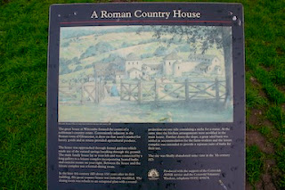
Considering that Great Witcombe must once have been among the gems of late Roman villas, and considering how well it survives (relatively speaking), it’s wonderful that it’s free and accessible at any time. Presentation is minimal; there’s no visitor centre, and only a single information board offers a reconstruction of the villa in its heyday.

But I’m not calling Great Witcombe ‘hidden’ because it lies (literally) off the beaten track – rather, because we have yet to unearth its real secrets. The surviving foundations give a decent idea of the layout of the villa, bearing in mind that everything visible has been ‘tidied up’ since the original nineteenth-century excavations – and nineteenth-century excavations were certainly not up to the standard of modern ones. Antiquarians often dug down to get to the good stuff, i.e. solid foundations and interesting finds, without realising that simple layers of soil can tell us so much about the use and development of a site.

Original buttresses, built to stop the villa slipping down the rather steep slope
Still, the surviving foundations are impressive enough, especially when you soak in the gorgeous bucolic setting. But there is much more to Great Witcombe than meets the eye. In 1999 the site owners, English Heritage, commissioned Cotswold Archaeology to undertake topographical and geophysical surveys of the villa and its environs, and these threw up some tantalising results.

First of all, the surveys suggest that we currently see only the uppermost parts of the villa – the two wings may actually extend almost twice as far as the currently exposed remains. What you now see could be just the upper of two full courtyards running down the slope. At the bottom of the slope, along the banks of a stream, there also seems to be a 2-acre enclosure that contained several buildings, including an earlier villa. Nearby is a possible water mill. Elsewhere there is evidence for a pottery kiln and other large-scale industrial activity, substantial terracing and landscaping, and – most intriguing of all – a possible temple-like structure on a slope overlooking the villa.

Basically, at Great Witcome we’re only seeing the cherry right now. The rest of the cake is still hidden from view, buried under turf but mercifully undisturbed by later agriculture. This was clearly one of the most important villas of late Roman Britain – a bustling community of agriculture, industry, culture and religion. Who knows what secrets lie beneath the surface in this secluded little combe, just waiting to be unearthed by the spades of future archaeologists?

Friday, 27 December 2013

The Darts of Mars

Fancy having these nasty-looking beasts raining down on your head?

These are plumbatae, lead-weighted darts that are a distinctively late Roman weapon. Originally they would have had wooden shafts ending with fletchings, rather like mini-javelins.

Each infantry soldier would carry about five of these nasty weapons behind his shield, ready to hurl them in advance of a charge. They would be flung (possibly underarm) high above the enemy ranks, with the lump of lead giving them extra force as they plummeted down.

Plumbatae were so deadly, they became known as Martiobarbuli – the ‘darts of Mars’ – and some regiments were specialists in their use.

These examples are from the museum at Wroxeter Roman City museum, which I visited earlier this year, and provide some of the best evidence we have for regular Roman garrisons in the cities of late Roman Britain.